11-09-2010, 08:07 PM
Gary;
Pretty sure that the Bing "Birds Eye" views are taken from aircraft.
Another thing that I've noticed happen, is often when following a rail line, when I pan back to a previous location, the view will be completely different then when I first went over the same area. Then I can pan back again and get the original view. Can't quite figure that one out.
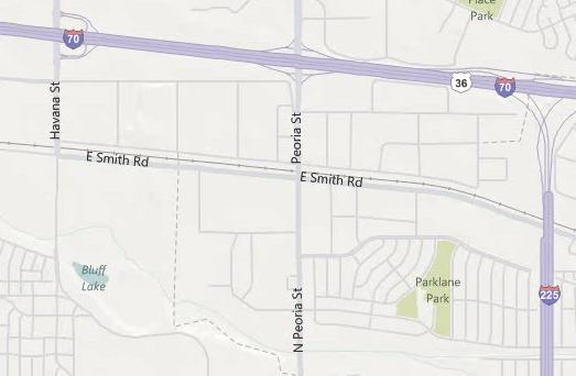
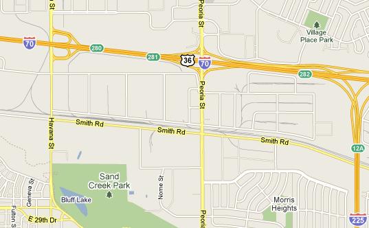
I've noticed that the satellite images on Google are usually of a better quality than Bing, not to mention the road map view. Bing does not show rail lines on their map views with the detail that Google does, so if you're using the road map view of Bing, you are very likely to pass up interesting rail areas.
Examples of what I mean are the area where I found the derailment...
Here's the Google Road Map
And the same area in Bing Road Map
In either case, the satellite images are dependent upon individual states. For instance, satellite views in Indiana are so good you can almost count the ties on the track any where you view a rail line in the state. In my home state of Kentucky, you only get quality images like that in the most populated areas, the rest of the state the quality is very poor. I just wish that the Bing "Birds Eye" views were available everywhere, but guess that will come in time.
I've also found the Google Street views to be very handy where available. If the street view is available on a street that runs next to or through an industrial park, you can really get some good detail views of the structures, etc.
Ed
"Friends don't let friends build Timesavers"
"Friends don't let friends build Timesavers"


