12-11-2010, 06:16 AM
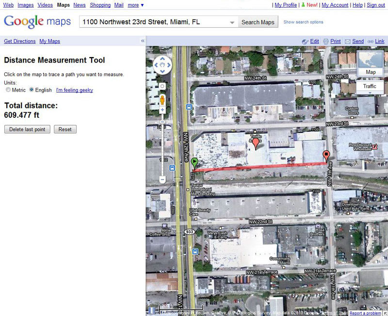
Don't know if anyone else has seen this, but Google Maps now has a distance measuring tool which can be really handy to measure the length of track and structures, especially in the satellite (aerial) view.
To access this feature click on New! at the top right of the page. You'll then get a menu of new features Google Maps Labs. On that menu select Enable on the distance measurement tool and then Save Changes.
Once you do that you'll see a small blue square in the lower left corner with a scale on it. To measure a distance, such as the length of a track or structure; click the blue square, the sidebar will open with instructions to "Click on the map to trace a path you want to measure" and the option to use Metric or English Units.
Simply click on your first point, then second point and the distance will be displayed in the sidebar. Seems to be fairly accurate, and pretty darn handy for determining the length of tracks/structures for our layouts.
Here's an example showing the length of the Trujillo & Sons building in Miami, FL (see Lance Mindheim's Downtown Spur) http://www.lancemindheim.com/downtown_spur2.htm
Ed
"Friends don't let friends build Timesavers"
"Friends don't let friends build Timesavers"


